Resources
Featured
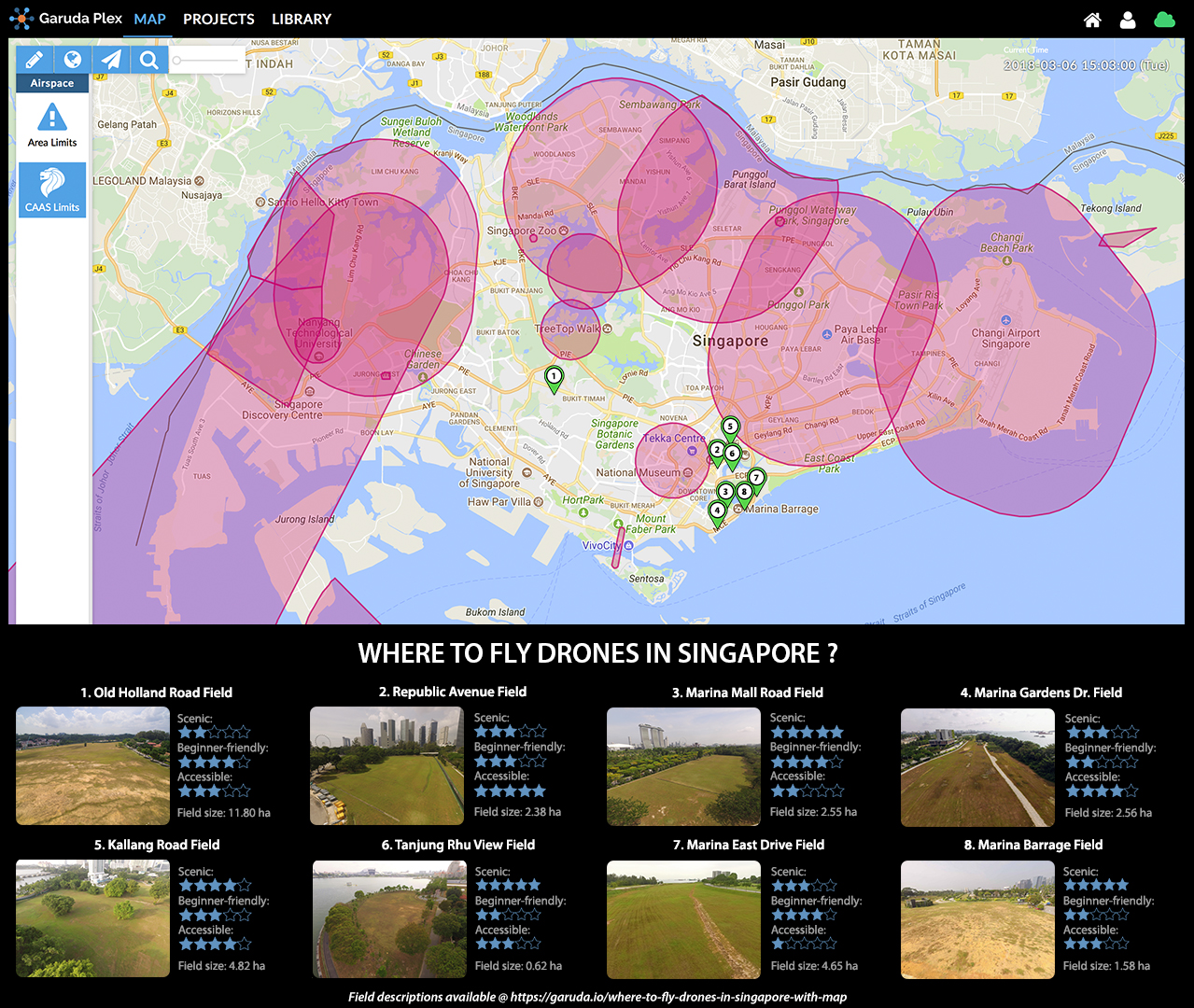
Where to Fly Drones in Singapore?
Company News & Updates

Spirit of Enterprise Awards 2022
Co-founders of Garuda Robotics receiving the Spirit of Enterprise (SOE) Award 2022 from Minister of State Low Yen Ling and SOE President Rachel Wong. On 28 Nov 2022, Mark and Jiin Joo joined 44 other companies to be recognised with the Spirit of Enterprise (SOE) Award...
Garuda Robotics and OneSky Partner to Provide UTM Services in Malaysia
Garuda Robotics and OneSky to showcase Uncrewed Aircraft Traffic Management (UTM) services collaboration efforts at the Drone & Robotics Zone (DRZ) Iskandar Drone Test Site (DTS) in Iskandar Puteri. Garuda Robotics (GR), in an exclusive partnership with OneSky,...
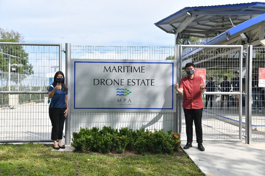
Drone Testing at Maritime Drone Estate
See the area for MDE on Garuda Plex or MyDroneFleets. For the application to use the MDE to run trials, you will need to provide MPA with the following details: Company Name UEN Number Name and contact details of applicant Description of business case and how do you...
Tech Blog
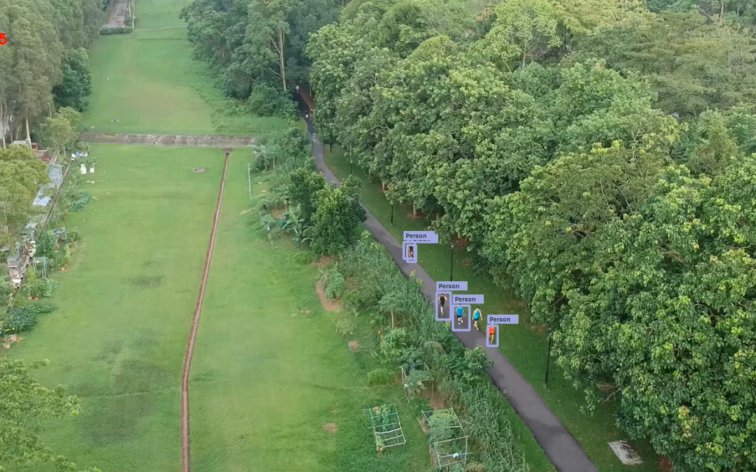
Safe Distancing in Parks: Deep Learning Approach to Crowd Estimation
Crowd Estimation at Green Spaces While Singapore’s Circuit Breaker has lifted, safe distancing may remain a need for the foreseeable future, as we continue to slow the spread of the coronavirus. During this period, authorities will need to continue to ensure safe...
More Articles

Deep Learning Computer Vision: Augmenting Drone Operations with AI
As drone technology evolves, the quality of camera footage and recording from drones have improved as well. Today we can get high resolution images from just about any commercial drone. This has pushed all vertical domain owners who invested heavily into drone...
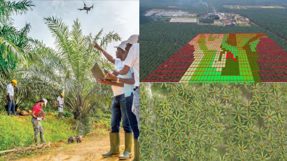
Reduce the need for manpower in your oil palm plantation with AI
Accurate oil palm census data is very useful for oil palm planters for costing, budgeting and forecasting purposes. Traditionally, planters will deploy their workers to tour entire estates to count the trees manually which is time-consuming and inefficient. Faced with...
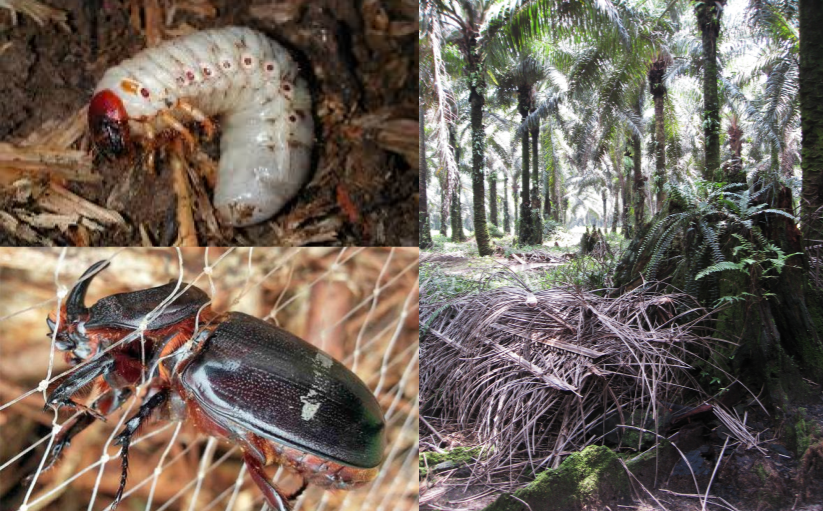
Connecting the dots: Rhino beetles and Dead Palms
Today, in addition to reports from the field workers and ground surveys, estate managers can make use of drones for mapping and monitoring of their estates. However, with more data, each with its own data management and analysis processes, it becomes increasingly...