Tree Counts and Geoanalytics
With high-resolution aerial maps and up-to-date and accurate tree count data, you could save up to 25% of your fertilizer cost every year for the next 10 years. Plantation 4.0 is designed to enable the future of smart plantations, where aerial data and AI work together for efficiency and productivity.

Drone Map Hosting
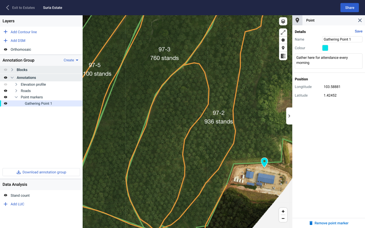
Store and access all your drone maps on a single platform. Enrich them by adding your own annotations or to share notes.

Plantation Management
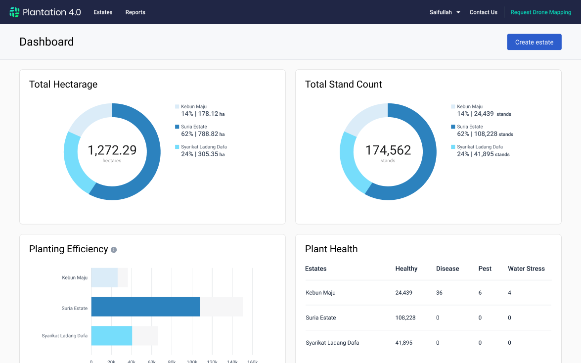
View key performance indicators for your estate including land use area, tree count & planting efficiency to help you maximize your yield.

Automated Tree Counting
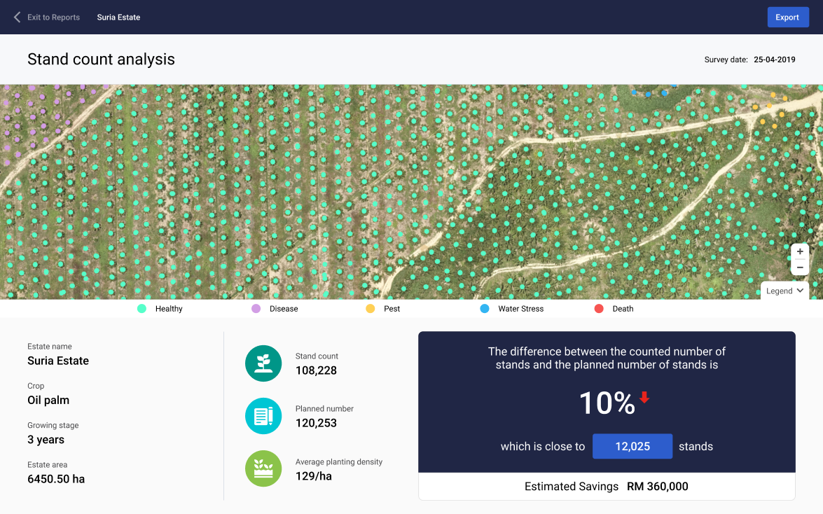
Get an accurate count of palms in your estate to budget for the right amount of fertilizer and labor within a day with our AI-powered tree count algorithm.
How It Works

Drone Map Hosting
- Store drone maps of your estates on the Cloud so you can access them anytime, anywhere without worrying about maintaining your own hardware
- Enrich your maps by annotating features such as roads, rivers or mills or communicate with others about assets or points of interest.

Plantation Management
- View and compare performance of your estates with key indicators such as planting efficiency on an easy-to-use dashboard
- Enable data-driven plantation management to improve yield and profit

Plantation Management
- View and compare performance of your estates with key indicators such as planting efficiency on an easy-to-use dashboard
- Enable data-driven plantation management to improve yield and profit

Oil Palm Detection & Counting
- Receive a geo-located oil palm inventory for your estate within a day
- Link critical information such as health status to individual palms
- Budget for the right amount of fertilizer with greater confidence with accurate palm count data
Pricing
Map Processing
Orthomosaic Map Generation
RM 2.20 / ha
Topographic Map Generation (DTM/DSM/Contours)
RM 2.20 / ha
Multispectral Map Generation (Per band)
RM 2.20 / ha
Annotation & Digitization Service
RM 4.00 / ha
Analytics
Oil Palm Detection & Counting
RM 2.20 / ha
Planting Density Analysis
RM 1.70 / ha
Customised to Your Plantation Needs
Our capabilities extend beyond Map Processing and Analytics.
Send us an inquiry to learn how we can provide customised reports to suit your unique plantation needs.
Riparian Zone
Identify riparian reserve in your estates based on MSPO guidelines.
Terrain Analysis
Terrain Analysis for land preparation and soil conservation.
Land-Use Utilisation
Identify where and how many more additional oil palms you can plant in your estates.
Palm Health Analysis
Identify oi palms with poor health or other anomalies in your estates.


